Curbridge, Hampshire
From Wikishire
Revision as of 22:50, 1 October 2022 by RB (Talk | contribs) (Created page with "{{Infobox town |name=Curbridge |county=Hampshire |picture=Tidal part of River Hamble at Curbridge - geograph.org.uk - 219766.jpg |picture caption=Tidal part of [[River Hamble]...")
| Curbridge | |
| Hampshire | |
|---|---|
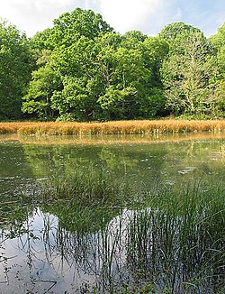
 Tidal part of River Hamble at Curbridge | |
| Location | |
| Grid reference: | SU525115 |
| Location: | 50°54’11"N, 1°15’44"W |
| Data | |
| Post town: | Southampton |
| Postcode: | SO30 |
| Dialling code: | 01489 |
| Local Government | |
| Council: | Winchester |
| Parliamentary constituency: |
Meon Valley |
Curbridge is a hamlet in Hampshire, in the south of the county, in the lands left rural to the south-east of Southampton’s urban swell, quietly sitting by a creek which here enters the tidal River Hamble.
The A3051 runs through, to Botley in the north and Swanwick to the south.
| ("Wikimedia Commons" has material about Curbridge, Hampshire) |