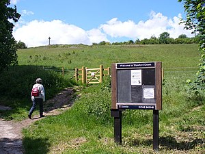
Shawford Down
| Shawford Down | |
| Hampshire | |
|---|---|

| |
| SU470248 51°1’16"N, 1°19’50"W | |
Shawford Down is a small hill in the midst of Hampshire to the south of Winchester. It climbs from the south edge of the small village of Shawford and to east and west it is squashed between the Winchester to Southampton railway line and the M3 motorway.
The hill, in an area of 48½ acres is a Local Nature Reserve, owned by the council and managed by Hampshire Countryside Service.[1]
The down has strip lynchets, dating to the period in the Middle Ages when the area was cultivated as common land. The site has a range of chalk grassland habitats, with flora including wild parsnip, red bartsia, cowslip and common rock-rose. There are also areas of woodland and scrub.[1]
| ("Wikimedia Commons" has material about Shawford Down) |
References
- ↑ 1.0 1.1 "Shawford Down". Natural England. https://designatedsites.naturalengland.org.uk/SiteLNRDetail.aspx?SiteCode=L1481381&SiteName=&countyCode=19&responsiblePerson=&SeaArea=&IFCAArea=. Retrieved 27 May 2020.
