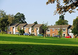
Abbotts Barton
| Abbotts Barton | |
| Hampshire | |
|---|---|
 Charles Close, Abbotts Barton | |
| Location | |
| Grid reference: | SU484308 |
| Location: | 51°4’25"N, 1°18’39"W |
| Data | |
| Post town: | Winchester |
| Postcode: | SO23 |
| Dialling code: | 01962 |
| Local Government | |
| Council: | Winchester |
| Parliamentary constituency: |
Winchester |
Abbotts Barton is a village in Hampshire, which has become effectively a suburb of the county's ancient county town, Winchester. It stand just under a mile north-east of the city centre.
In 1887, John Bartholomew's Gazetteer of the British Isles described Abbots Barton as:
Abbots Barton, seat, near Winchester, Hants.[1]
Outside links
| ("Wikimedia Commons" has material about Abbotts Barton) |
References
- ↑ "A Vision of Britain Through Time: Abbotts Barton". GB Historical GIS/University of Portsmouth. http://www.visionofbritain.org.uk/place/4013/writing. Retrieved 27 January 2016.

This Hampshire article is a stub: help to improve Wikishire by building it up.
