Narin
| Narin Irish: An Fhearthainn | |
| County Donegal | |
|---|---|
 Narin strand | |
| Location | |
| Grid reference: | G818944 |
| Location: | 54°50’19"N, 8°26’47"W |
| Data | |
| Local Government | |
Narin is a small seaside village in the parish of Ardara on the south-west coast of County Donegal, five miles north of Ardara.
The land is rough rolling bogland with craggy low hills. Narin Strand is a sand beach approximately a mile long. Ofshore lies Inishkeel Island, about 250 yards from the mainland in Gweebarra Bay and can be reached on foot at low tide by crossing a tidal sand bank.
The population of Narin is spread sparsely around the countryside in mostly modern housing.
About the village
There is a large tourist trade served by several bed and breakfasts and caravan parks. Local amenities consist of a pub, caravan park shop and public toilets. There is also an 18-hole golf links with club house.
Pictures
| ("Wikimedia Commons" has material about Narin) |
-
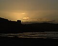 Sunset over Portnoo from Narin Strand
 -
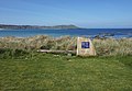 10th hole of the Narin & Portnoo Golf Club
 -
 Narin & Portnoo Golf Club


