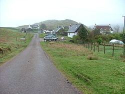
Achosnich
| Achosnich Gaelic: Achadh Osnaich | |
| Argyllshire | |
|---|---|
 Achosnich | |
| Location | |
| Grid reference: | NM451667 |
| Location: | 56°43’20"N, 6°10’4"W |
| Data | |
| Postcode: | PH36 |
| Local Government | |
| Council: | Highland |
| Parliamentary constituency: |
Ross, Skye and Lochaber |
Achosnich is a crofting township in the long peninsula of Ardnamurchan, in north-western Argyllshire. It is close to Ardnamurchan Point, the westernmost extent of mainland Great Britain. Though Achosnich is the closest place to the point, it is narrowly beaten to the title of the westernmost hamlet of the mainland by Portuairk to the north-west and the clutch of cottages known as Grigadale between Achnsnich and the point.
The hamlet is to be found at the end of the B8007 road which is the major road of the Ardnamurchan peninsula.