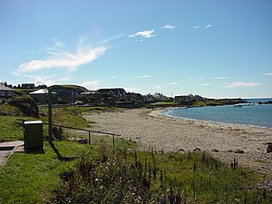
Machrihanish Bay

Machrihanish Bay is a large, remote tidal bay on the west side of the Kintyre peninsula of Argyllshire facing north by north-east onto the Atlantic Ocean. It indents the coast next to the Campbeltown Airport.
This bay has the longest continuous stretch of sand in Argyll.[1]
Villages
The closest settlement to Machrihanish Bay is the small village of Machrihanish which sits on the headland at the south end of the bay. Directly east of the bay lies Campbeltown Airport. On the other side of the peninsula, three miles to the east, stands Campbeltown, Kintyre's only town. To the north of the airport and close to the northern shore of the bay, is the village of West Darlochan.
The main A83 road coming from the north follows the west coast of Kintyre to the north coast of the bay, where it cuts east to Campbeltown, by way of the wee villages of Kilchenzie, Glencraigs, Drumore. The B842 comes to the bay from Campbeltown.
Geography
- Location map: 55°26’8"N, 5°44’1"W
To the north of the bay, around two miles away, lies Bellochantuy Bay. A mile to the south of the bay is Earadale Point, where the peninsula starts to curve inwards to the east. To the south of the bay lies the forested hill of The Slate, with the larger hill of Cnoc May which overlooks the bay, four miles to the northeast. The river Machrihanish Water flows into the bay.
| ("Wikimedia Commons" has material about Machrihanish Bay) |
- Images of Machrihanish Bay
-
Machrihanish Bay. Looking on from Cnoc Moy.
-
Beach & dunes at Machrihanish Bay.
-
Beach & dunes.
-
Beach at Machrihanish Bay, looking north.
-
Information boards at Machrihanish Bay
References
- ↑ Rob Humphreys; Darren (Norm) Longley; Helena Smith (1 May 2014). The Rough Guide to Scottish Highlands & Islands. Rough Guides Limited. p. 130. ISBN 978-0-241-00768-6. https://books.google.com/books?id=4i8xAwAAQBAJ&pg=PT130.


