Shelton, Nottinghamshire
| Shelton | |
| Nottinghamshire | |
|---|---|
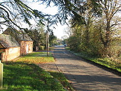
 Main Street, Shelton | |
| Location | |
| Grid reference: | SK779446 |
| Location: | 53°0’0"N, -0°50’24"W |
| Data | |
| Population: | 307 (2011) |
| Post town: | Newark |
| Postcode: | NG23 |
| Local Government | |
| Council: | Rushcliffe |
| Parliamentary constituency: |
Rushcliffe |
Shelton is a village in Nottinghamshire; a small village, with a population recorded at the 2011 census as 307. The village is eight miles south of Newark-on-Trent, on the north side of the River Smite, near where it joins the River Devon.
About the village
The parish church of St Mary is Norman. The west tower was removed in 1837 and replaced with a bellcote. It has an Anglo-Saxon cross shaft with interlace work.
Shelton Hall to the west of the church dates from the late 18th century.[1]
Outside links
| ("Wikimedia Commons" has material about Shelton, Nottinghamshire) |
References
- ↑ Nikolaus Pevsner: The Buildings of England: Nottinghamshire, 1951; 1979 Penguin Books ISBN 978-0-300-09636-1page 309
