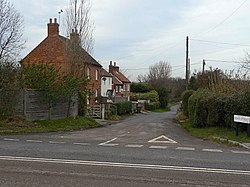
Saxondale, Nottinghamshire
| Saxondale | |
| Nottinghamshire | |
|---|---|
 Main Street, Saxondale | |
| Location | |
| Grid reference: | SK682398 |
| Location: | 52°57’7"N, -0°59’10"W |
| Data | |
| Post town: | Nottingham |
| Postcode: | NG13 |
| Dialling code: | 01949 |
| Local Government | |
| Council: | Rushcliffe |
| Parliamentary constituency: |
Rushcliffe |
Saxondale is a small hamlet in the south of Nottinghamshire, just off the A52 road near to its junction with the A46 road, between Bingham (from which it is separated by the A52 trunk road) and Radcliffe on Trent. There is evidence of an Anglo-Saxon fort here, with earthworks visible from the main road.
The village is just south of the Nottingham to Grantham railway line where there is still evidence of a spur, known as the Barnstone branch, from the former Saxondale Junction through present-day Bingham to Melton Mowbray. Close by is a new residential area named Upper Saxondale, a redevelopment of the former Saxondale Hospital site.
Outside links
| ("Wikimedia Commons" has material about Saxondale, Nottinghamshire) |
