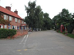
Morton, Nottinghamshire
| Morton | |
| Nottinghamshire | |
|---|---|
 Main Street Morton | |
| Location | |
| Grid reference: | SK726511 |
| Location: | 53°2’60"N, -0°55’12"W |
| Data | |
| Post town: | Newark |
| Postcode: | NG25 |
| Local Government | |
| Council: | Newark and Sherwood |
Morton is a village in the east of Nottinghamshire, just half a miles west of the larger village of Fiskerton and the broad River Trent. It is four and a half miles south-west of Newark-on-Trent. The Nottingham to Newark stretch of the main railway line runs along the edge of the village.
The parish church St Denis, was built in 1756,[1] and is a Grade II* listed building. The current organ was installed in 1967 by Cantril of Castle Donington. It was originally built by W Hadfield of London. The church is in a joint parish with: St Peter and St Paul's Church, Upton and Holy Trinity Church, Rolleston.

Outside links
| ("Wikimedia Commons" has material about Morton, Nottinghamshire) |
References
- ↑ Nikolaus Pevsner: The Buildings of England: Nottinghamshire, 1951; 1979 Penguin Books ISBN 978-0-300-09636-1page 180

This Nottinghamshire article is a stub: help to improve Wikishire by building it up.
