Gamston, Bassetlaw
| Gamston | |
| Nottinghamshire | |
|---|---|
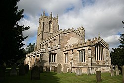
 St Peter's Church, Gamston | |
| Location | |
| Grid reference: | SK705765 |
| Location: | 53°16’48"N, -0°56’24"W |
| Data | |
| Population: | 246 (2011) |
| Post town: | Retforrd |
| Postcode: | DN22 |
| Dialling code: | 01777 |
| Local Government | |
| Council: | Bassetlaw |
| Parliamentary constituency: |
Newark |
Gamston is a village four miles south of Retford in Nottinghamshire. The River Idle lies to the west of the village. Gamston is on the A638 road between Retford and the Markham Moor junction with the A1 and the A57 roads.
The population of the civil parish as at the 2011 Census was 246.
The parish church is St Peter's, a Grade I listed building.
There used to be a rectory in the village: today it gives a name to a lane in the village.
To the east of the village, beyond the East Coast railway line, is Gamston Wood. The ancient parish wood[1] was purchased by the Forestry Commission in 1984 and covers 101 acres. The area has been designated as a Site of Specific Interest.
Retford Gamston Airport
- Main article: Retford Gamston Airport
Retford Gamston Airport, a former RAF aerodrome, is a small airport based to the west of the village on the B6387 road. The airport is used for small private aircraft as well as the base for several flying schools.
Outside links
| ("Wikimedia Commons" has material about Gamston, Bassetlaw) |
References
- ↑ "Country Walk Summary – GAMSTON WOOD Near RETFORD". Department for Environment, Food and Rural Affairs. http://cwr.defra.gov.uk/Default.aspx?Module=CountryWalkDetails&Site=3532. Retrieved 1 June 2008.

This Nottinghamshire article is a stub: help to improve Wikishire by building it up.
