Sallynoggin
| Sallynoggin Irish: An Naigín | |
| County Dublin | |
|---|---|
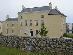
 Eaglewood House, Sallynoggin | |
| Location | |
| Grid reference: | O239267 |
| Location: | 53°16’36"N, 6°8’33"W |
| Data | |
| Population: | 6,283 (2006) |
| Postcode: | A96 |
| Dialling code: | 01 |
| Local Government | |
| Council: | Dún Laoghaire–Rathdown |
| Dáil constituency: |
Dún Laoghaire |
Sallynoggin is a village of County Dublin, within the conurbation that fills much of that county, to the south of Dublin itself. The area consists mainly of former local authority housing built between the late 1940s and the mid-1950s by Dún Laoghaire Borough Corporation.
On early 20th century maps, Sallynoggin and Glenageary are indicated as being the same place, however, with the development of the local authority housing estate on the Townlands of Honeypark and Thomastown, Sallynoggin became a distinct area.
Name
The Irish Placenames Commission has researched the origin and meaning of Sallynoggin as a placename. In fact, the name is not Irish at all but English deriving from the "sally noggins" which referred to old timber-frame houses that were known to be situated there. The modern Irish word for noggin is the phonetic "naigín" hence "An Naigín" (The Noggin) as it is commonly called.
More than likely this is a placename of English origin. Examples of the word naggin or noggin were collected in Hiberno-English, meaning 'a wooden vessel'. The origin of the word is unclear to lexicographers. The following meaning of the word noggin also appears in the English Dialect Dictionary, 'the clay and sticks, or bricks used to fill the interstices of half-timbered houses'. This is a more likely explanation of 'sallynoggins'; in other words, sally-rods may have been used in the construction of the houses.[1]
About the village
There are playing fields on either side of Sallynoggin Road with a clubhouse for St Josephs Boys AFC football club on Pearse Road.
There are both large and small retail units in Sallynoggin, including on Sallynoggin Road, Pearse Street and Church Place.
Sallynoggin has a primary school, St. Kevin's National School, located on Pearse Street, from which some pupils move on to the nearby Holy Child Community School. The former Technical School on Pearse Street is now the Sallynoggin College of Further Education. Rathdown School, a Church of Ireland girls' school is located here too.
Sallynoggin Youth and Community Centre, opened in October 2008.[2]
| ("Wikimedia Commons" has material about Sallynoggin) |
