Kilbarrack
| Kilbarrack Irish: Cill Bharróg | |
| County Dublin | |
|---|---|
| Location | |
| Grid reference: | O231386 |
| Location: | 53°22’60"N, 6°9’0"W |
| Data | |
| Local Government | |
| Council: | Dublin |
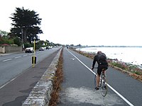
Kilbarrack is a village of County Dublin, now within the conurbation, running inwards from the coast, about five miles from Dublin city centre. It is beside Bayside, a district formed from Kilbarrack's old core. Its coastal area faces Bull Island across the water known as Raheny Lake or Crab Water.
The name 'Kilbarrack' is from the Irish Cill Bharróg meaning 'Church of St. Berach' or 'Church of young Barra'.
History and nature
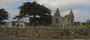
Kilbarrack is an old district, whose name can be found on maps and sea charts going back several hundred years. It was historically a large area of fields, many being 'grange' lands held by Dublin church establishments, with small settlements. Over time, two hamlets emerged, Kilbarrack proper, near the seafront, close to the still-extant Kilbarrack Church and Graveyard complex (illustrated below), and Little Kilbarrack, on the road inland (now Tonlegee Road).
The district is crossed by one of Dublin's small waterways, the Kilbarrack Stream or Donough Water, which enters the sea in two branches.

The coastal church and surrounding graveyard were a point of call for mariners, and the church is noted in some records as the Chapel of Mone. At one time, ships entering Dublin Bay paid monies to the city authorities towards the upkeep of the chapel. The cemetery, which still accepts burials in existing graves, includes the grave of the "Sham Squire."
The site of Kilbarrack hamlet, and the part of the district bounding Sutton and Baldoyle, are now together known as Bayside (from inside Kilbarrack Road to Baldoyle Road), while today's Kilbarrack, and the Greendale shopping and civic complex, are close to where Little Kilbarrack stood. The Tesco-led shopping centre is near the site of the former "big house" of the area, Kilbarrack House.
In the 1970s, Swans Nest Court, a complex of tower blocks of flats was built by Dublin Corporation. It was demolished and redeveloped into social and affordable housing in the early 2000s after it fell into disrepair.
Sport
- Boxing: Bay City Boxing Club
- Gaelic sports: Naomh Barrog GAA
- Football: Kilbarrack United FC[1]
- Kilmount Boys FC

In popular culture
The 1996 film The Van, part of Roddy Doyle's Barrytown trilogy, was filmed in Kilbarrack.
Roddy Doyle was a teacher in Kilbarrack before he began his career as a writer. He captured the atmosphere and spirit of Kilbarrack, thinly disguised as Barrytown, in a series of popular fiction works.[2]
Outside links
| ("Wikimedia Commons" has material about Kilbarrack) |
References
- ↑ Kilbarrack United
- ↑ Sbrockey, Karen (Summer 1999). "Something of a hero: An interview with Roddy Doyle". Literary Review 42 (4): 537–552.
