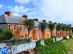
Ballybough
| Ballyborough Irish: An Baile Bocht | |
| County Dublin | |
|---|---|
 Ballybough | |
| Location | |
| Grid reference: | O165354 |
| Location: | 53°21’23"N, 6°15’3"W |
| Data | |
| Local Government | |
Ballybough is an inner city district of northeast Dublin. Its name is given in Irish as An Baile Bocht, meaning 'The poor town'.
The bridge here crosses the River Tolka. It is known as Ballybough Bridge (if now officially renamed Luke Kelly Bridge) and it is a bridge here which is believed to have formed the central point of the Battle of Clontarf.[1]
The place is to be found north of Summerhill Parade at The Tom Clarke Bridge, which separates central Dublin from Ballybough Village. Adjacent areas include the North Strand and Clonliffe. Before its urbanization in the late 19th century, Ballybough was known as Mud Island, owing to its proximity to the mud flats that now form Fairview and environs. Ballybough can be seen on the old maps as the original coast road now replaced by the North Strand Road.
There is an old Jewish cemetery, Ballybough Cemetery, on Fairview Strand near Ballybough Bridge. Inspired by this cemetery Dublin poet Gerry McDonnell wrote his collection of poetry, 'Mud Island Elegy', on the Jewish community of Ireland in the 19th century.
In the distant past, this was a district that attracted characters of ill-repute, drunks, prostitutes, and pirates. James Clarence Mangan used the pseudonym 'Peter Puff Secundus, Mud Island, near the bog’ to identify with the area. Here the authorities designated an area of burial known colloquially as 'the Suicide Plot'.
During the land reclamation project of the 19th century, Mud Island was also known, interchangeably, as Friend's Field or French Field, before it became known by its current name. The village of Ballybough traces its origins to a series of small dwellings known as Ballybough Cottages, which were later demolished to make way for the Dublin Corporation housing project known as Ballybough House.
Stadium
Close by at Jones's Road is Croke Park, the headquarters of the Gaelic Athletic Association. This sports stadium is among the most modern in Europe with a capacity of 82,300. In addition to hurling and Gaelic football, it is used as a concert venue. The stadium was where world boxing champion Muhammad Ali defeated 'Al Blue' Lewis in a non-title fight in 1972.
References
- ↑ Torchiana, Donald T. (22 December 2015). Backgrounds for Joyce's Dubliners. ISBN 9781317286844. https://books.google.com/books?id=oEhACwAAQBAJ&q=joyce+tries+to+reach+the+pigeon+house&pg=PA42.