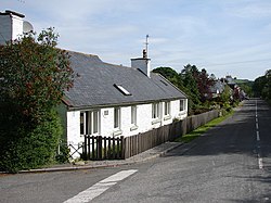
Gelston, Kirkcudbrightshire
| Gelston | |
| Kirkcudbrightshire | |
|---|---|
 Gelton | |
| Location | |
| Grid reference: | NX769586 |
| Location: | 54°54’26"N, 3°55’12"W |
| Data | |
| Postcode: | DG7 |
| Local Government | |
| Council: | Dumfries & Galloway |
| Parliamentary constituency: |
Dumfries & Galloway |
Gelston is a hamlet in Kirkcudbrightshire, at a crossroads on the B727 two miles south of Castle Douglas. The Gelston Burn runs along the eastern edge of the hamlet.
Immediately to the south-east of the hamlet is Gelston Castle.