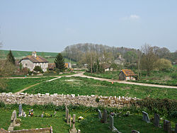
Winterborne Monkton
| Winterborne Monkton | |
| Dorset | |
|---|---|
 Winterborne Monkton | |
| Location | |
| Grid reference: | SY676878 |
| Location: | 50°41’24"N, 2°27’31"W |
| Data | |
| Population: | 50 (2013 est.) |
| Post town: | Dorchester |
| Postcode: | DT2 |
| Local Government | |
| Council: | Dorset |
| Parliamentary constituency: |
West Dorset |
Winterborne Monkton is a small village in Dorset, lying close to the A354 road between the county town, Dorchester a mile and a half to the north, and Weymouth five miles to the south. A In 2013 a mid-year estimate of the parish population gauged it as 50.
Winterborne Monkton village consists of a few houses and a church. A major Iron Age hill fort, Maiden Castle, stands to the north-west.
Outside links
| ("Wikimedia Commons" has material about Winterborne Monkton) |
