West Stafford
| West Stafford | |
| Dorset | |
|---|---|
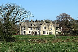
 Stafford House, West Stafford | |
| Location | |
| Grid reference: | SY726895 |
| Location: | 50°42’18"N, 2°23’20"W |
| Data | |
| Population: | 291 (2011) |
| Post town: | Dorchester |
| Postcode: | DT2 |
| Local Government | |
| Council: | Dorset |
| Parliamentary constituency: |
West Dorset |
West Stafford is a village in south-western Dorset, in the Frome valley two miles east of Dorchester. The 2011 census noted a parish population of 291.
The village contains the public house 'The Wise Man Inn', and St Andrew's Church. The River Winterbourne runs beside the village and two miles south is the village of West Knighton.
Thomas Hardy, when training as an architect, assisted in the design of Talbothays Lodge and the cottages opposite. The village is also accepted as the setting for part of Hardy's novel Tess or the D'Urbevilles, during the period when Tess works at the Talbothays Dairy.
Outside links
| ("Wikimedia Commons" has material about Stafford West Stafford) |
