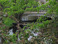
Uckington, Gloucestershire
| Uckington | |
| Gloucestershire | |
|---|---|
 Uckington Moat | |
| Location | |
| Grid reference: | SO917249 |
| Location: | 51°55’23"N, 2°7’12"W |
| Data | |
| Post town: | Cheltenham |
| Postcode: | GL51 |
| Dialling code: | 01242 |
| Local Government | |
| Council: | Tewkesbury |
| Parliamentary constituency: |
Tewkesbury |
Uckington is a village west of Cheltenham in Gloucestershire, just escaping the clutches of the town's swollen urban area by a field's breadth. It is on the A4019 running north-west out of Cheltenham to the M6 motorway and the Vale of Gloucester.
The population of the parish taken at the 2011 census was 605.
Not having a church, Uckington is a hamlet in the parish of Elmstone Hardwicke, but is a 'civil parish' in its own right. The two villages share a village hall.
Nearby villages include Elmstone-Hardwicke and Boddington.
References

This Gloucestershire article is a stub: help to improve Wikishire by building it up.