Sunhill
| Sunhill | |
| Gloucestershire | |
|---|---|
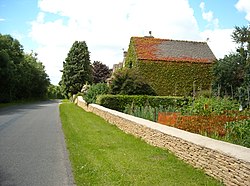
 Sunhill farmhouse | |
| Location | |
| Grid reference: | SP117026 |
| Location: | 51°43’19"N, 1°49’55"W |
| Data | |
| Postcode: | GL7 |
| Local Government | |
| Council: | Cotswold |
| Parliamentary constituency: |
The Cotswolds |
Sunhill is hamlet at the junction of a five-ways crossroads in south-eastern Gloucestershire.
Overview
Sunhill is located on the ancient Welsh Way about a mile northeast of the village of Poulton and is surrounded by other villages such as the well-known picturesque honeypot village of Bibury.
The main hamlet of Sunhill consists of three Cotswold stone houses, and a rendered bungalow. Of the houses, one is a barn conversion, adapted for living in approximately 1992. Another was much earlier converted from two farm-workers cottages into a single dwelling. The oldest buildings have been in place since the late 19th century. Slightly further afield, several other houses and barn conversions also form part of the hamlet.
There was a working quarry here for many years, but this has been disused for over 40 years, and has now been levelled to return it to agricultural use.