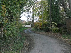
Hinton, Shropshire
| Hinton | |
| Shropshire | |
|---|---|

| |
| Location | |
| Grid reference: | SJ409080 |
| Location: | 52°39’60"N, 2°52’31"W |
| Data | |
| Postcode: | SY5 |
| Local Government | |
| Council: | Shropshire |
Hinton is a hamlet in Shropshire, a mile and a half north of Pontesbury and six miles south-west of Shrewsbury. It is by the Rea Brook, which enters the River Severn in Shrewsbury.

This Shropshire article is a stub: help to improve Wikishire by building it up.