Northwick, Gloucestershire
| Northwick | |
| Gloucestershire | |
|---|---|
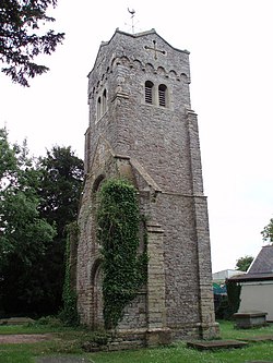
 St Thomas, Northwick | |
| Location | |
| Grid reference: | ST558867 |
| Location: | 51°34’40"N, 2°38’16"W |
| Data | |
| Postcode: | BS35 |
| Local Government | |
| Council: | South Gloucestershire |
Northwick is a hamlet in Gloucestershire, standing on the shore of the Severn Estuary, between Pilning and Aust. It was part of the tything of Northwick with Redwick in the ancient parish of Henbury.
The earliest appearance of the place in the records is in a charter of 955, in which it appears as Norowican.[1]
The church of St Thomas was declared redundant in 1971.
Outside links
| ("Wikimedia Commons" has material about Northwick, Gloucestershire) |
References

This Gloucestershire article is a stub: help to improve Wikishire by building it up.
