Angerton
| Angerton | |
| Lancashire | |
|---|---|
 Duddon Mosses | |
| Location | |
| Grid reference: | NY2283 |
| Location: | 54°14’20"N, 3°11’20"W |
| Data | |
| Population: | 14 (2001) |
| Post town: | Kirkby in Furness |
| Postcode: | LA17 |
| Dialling code: | 01229 |
| Local Government | |
| Council: | Westmorland & Furness |
| Parliamentary constituency: |
Barrow and Furness |
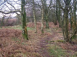
Angerton or Angerton Moss is an extra parochial spot in the Furness portion of Lancashire, on the Duddon estuary. It includes a few houses, Angerton Hall, and Angerton Marsh.
It became a civil parish following the Extra-Parochial Places Act 1857, and merged with Seathwaite with Dunnerdale and Broughton West CPs to form Duddon CP in 1976. The 2001 census recorded a population of 14. Owing to the minimal population, details from the 2011 Census were recorded in the parish of Kirkby Ireleth.
This Lancashire article is a stub: help to improve Wikishire by building it up.