Trentishoe Down
| Trentishoe Down | |||
| Devon | |||
|---|---|---|---|
 On Trentishoe Down | |||
| Range: | Exmoor | ||
| Summit: | 1,050 feet SS629477 51°12’46"N, 3°57’49"W | ||
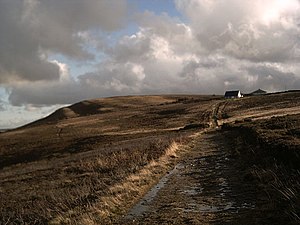
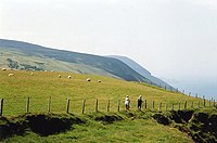
Trentishoe Down is a prominent coastal hill of 1,050 feet overlooking the north coast of Devon on the Bristol Channel and the valley of a tributary to the River Heddon. The hill belongs to the National Trust
On its summit are the Trentishoe Barrows; Neolithic cairns which are part of an ancient landscape of monuments and burial chambers found across these hills. Two round cairns, situated on the summit of Trentishoe Down are together a scheduled ancient monument.[1] overlooking and the Bristol Channel. The northern cairn survives as a circular stony mound with a diameter of 37 feet and is up to 3 feet high.

The South West Coast Path runs along the northern slope of Trentishow Down.
References
- ↑ National Heritage List 1002556: Trentishoe Barrows