West Rounton
| West Rounton | |
| Yorkshire North Riding | |
|---|---|
 West Rounton village | |
| Location | |
| Grid reference: | NZ413034 |
| Location: | 54°25’29"N, 1°21’51"W |
| Data | |
| Population: | 306 (2011 (inc. East Rounton)[1]) |
| Post town: | Northallerton |
| Postcode: | DL6 |
| Local Government | |
| Council: | Hambleton |
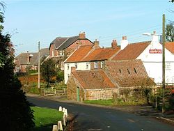
West Rounton is a village and parish in the North Riding of Yorkshire. It is eight miles north of Northallerton. East Rounton is about a mile away across the fields.
The church of St Oswald dates from the 12th century and was completely rebuilt in 1860 by architect James Pritchett. It is a Grade-II* listed building.[2]
West Rounton has two pubs, the Grey Horse (which is now closed) and the Horseshoe Inn.
References
| ("Wikimedia Commons" has material about West Rounton) |
- ↑ UK Census (2011). "Local Area Report – West Rounton Parish (1170216957)". Nomis. Office for National Statistics. https://www.nomisweb.co.uk/sources/census_2011_ks/report?compare=1170216957. Retrieved 21 February 2018
- ↑ National Heritage List 1293683: CHURCH OF ST OSWALD

This Yorkshire article is a stub: help to improve Wikishire by building it up.
