Wind Hill
| Wind Hill | |||
| Devon | |||
|---|---|---|---|
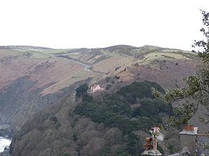
 Wind Hill, seen from Lynton | |||
| Range: | Exmoor | ||
| Summit: | 856 feet SS739493 51°13’44"N, 3°48’23"W | ||
Wind Hill is on the edges of Exmoor within Devon, close to Lynmouth.
The hill is most noted as the location of an Iron Age enclosure or "spur" hill fort. The site is effectively a hillside forming a spur or promontory between the steep valley of the East Lyn River to the south and the cliffs to the north.
Wind Hill's summit is at 856 feet above sea level, but the enormous earthworks defending the spur are at a lower level to the east.[1]
References
- ↑ Whybrow, Charles: 'Antiquary's Exmoor' (Exmoor Press, 1970) ISBN 0-9500133-4-X; page 24
- Sellman, R.R.: 'Aspects of Devon History' (Devon Books, 1985) ISBN 0-86114-756-1. Chapter: "The Iron Age in Devon" (Map of Iron Age hill forts in Devon)