Diptford
| Diptford | |
| Devon | |
|---|---|
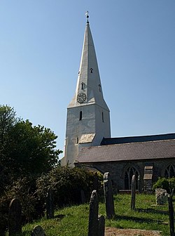
 St Mary's Church, Diptford | |
| Location | |
| Grid reference: | SX727567 |
| Location: | 50°23’40"N, 3°47’42"W |
| Data | |
| Post town: | Totnes |
| Postcode: | TQ9 |
| Local Government | |
| Council: | South Hams |
Diptford is a village in southern Devon, perched on a hill overlooking the River Avon. The name of the vilage is believed to come from "deep ford", referring to the local site of a river crossing.
At the centre of the village is a small primary school,[1] the parish hall and the recently redeveloped 14th-century church. There is a temporary pub called the Diptford Arms, which opens 4 times a year inside the village hall.