Begelly
| Begelly | |
| Pembrokeshire | |
|---|---|
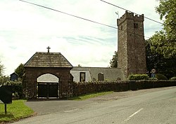
 Parish church of St Mary | |
| Location | |
| Grid reference: | SN118073 |
| Location: | 51°43’60"N, 4°43’36"W |
| Data | |
| Post town: | Kilgetty |
| Postcode: | SA68 |
| Dialling code: | 01834 |
| Local Government | |
| Council: | Pembrokeshire |
Begelly is a village and ancient parish in south Pembrokeshire, 4½ miles north of Tenby. The parish includes the hamlet of Thomas Chape and has a web of small settlements associated with the 19th-century anthracite mining industry. The parish, together with the parish of Reynalton and the Kilgetty part of St Issells, constitutes the civil community and ward of Kilgetty/Begelly, which had a population of 2,011 in 2001, with 11% Welsh speakers.
Name
The placename appears to be from the Welsh language, meaning "Bugail's territory".[1]
History
Part of Little England beyond Wales, it has been essentially English-speaking for 900 years. The parish had an area of 2,500 acres. Its census populations were: 354 (1801): 779 (1851): 445 (1901): 346 (1951): 500 (1981).
The percentage of Welsh speakers was 3.5 (1891): 5.0 (1931): 4.5 (1971).
References
- ↑ Charles, B. G., The Placenames of Pembrokeshire, National Library of Wales, Aberystwyth, 1992, ISBN 0-907158-58-7, p 472
Outside links

This Pembrokeshire article is a stub: help to improve Wikishire by building it up.