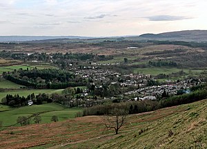
Template:FP-Strathblane
 |
StrathblaneStrathblane is a village in Stirlingshire, sitting beneath the foothills of the Campsie Fells and the Kilpatrick Hills on the Blane Water. It stands twenty miles south-west of the county town, Stirling, and just twelve miles north of Glasgow, for which it has become a commuter village. The parish includes the ancient seat of the Earls of Lennox, from whom Lennoxtown just to the east is named. To the west are the volcanic plug hill of Dumgoyne and the Loch Lomond and the Trossachs National Park. The West Highland Way long-distance trail passes close to the village. (Read more) |