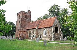
Sandon, Essex
| Sandon | |
| Essex | |
|---|---|
 St Andrew, Sandon | |
| Location | |
| Grid reference: | TL731052 |
| Location: | 51°42’54"N, 0°31’34"E |
| Data | |
| Population: | 1,612 (2011[1]) |
| Post town: | Chelmsford |
| Postcode: | CM2 |
| Dialling code: | 01245 |
| Local Government | |
| Council: | Chelmsford |
| Parliamentary constituency: |
Maldon & East Chelmsford |
Sandon is a small village and parish in the Chelmsford hundred of Essex, just off junction 17 of the A12, adjacent to Great Baddow and close to Danbury. The population taken at the 2011 census includes Howe Green and totals 1,612.[1] It was known for an ancient oak tree covering most of the village green. This rare Spanish oak was planted in 1888 to mark Queen Victoria's Golden Jubilee.[2] It was removed for safety reasons in 2000 after collapsing due to long-standing fungal infection (this oak tree was used by a local artist for many of his paintings, and is still represented on the village sign). Three new oak trees were planted on the village green to continue its legacy and mark Queen Elizabeth's Golden Jubilee.
Sandon has a secondary school, which is on Molrams Lane, the border between Sandon and Great Baddow. The Sandon School is an 11-18 mixed comprehensive academy school of 1,200 students.[3]
Sandon's only pub is The Crown, which is situated on the village green opposite St Andrew's Church. Foundation stones from a long-demolished village primary school can be spotted in the walls of the pub car park.
There are two pits located next to the A12. These are the results of gravel extraction during previous decades. In recent years these pits have been subject to an application to be utilised as landfill sites, but now have been planted on and are used by children as play areas and by dog walkers.
Major changes to the village over the last 40 years include the building of the Gablefields estate (on the east edge of the village) on the site of the old Gable Farm in 1975, the construction of the A12 bypass further to the east around 1986, and the construction in the intervening area of an extension to Gablefields, The Lintons, in the 1990s.
References
| ("Wikimedia Commons" has material about Sandon, Essex) |
- ↑ 1.0 1.1 "Civil Parish population 2011". Neighbourhood Statistics. Office for National Statistics. http://www.neighbourhood.statistics.gov.uk/dissemination/LeadKeyFigures.do?a=7&b=11128187&c=Sandon&d=16&e=62&g=6423848&i=1001x1003x1032x1004&o=362&m=0&r=1&s=1473002686511&enc=1. Retrieved 4 September 2016.
- ↑ "The Jubilee Oak - A Sense of Place - Programme Six". BBC. http://www.bbc.co.uk/pressoffice/pressreleases/stories/2002/04_april/19/jubileeoak.shtml. Retrieved 17 May 2012.
- ↑ "The Sandon School". DfE. 2012. http://www.education.gov.uk/establishments/urn/137240/the-sandon-school. Retrieved 17 May 2012.

This Essex article is a stub: help to improve Wikishire by building it up.
