Wimbish
| Wimbish | |
| Essex | |
|---|---|
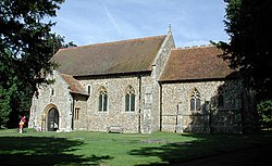
 All Saints church, Wimbish | |
| Location | |
| Location: | 52°0’25"N, -0°18’21"E |
| Data | |
| Population: | 1,629 (2011[1]) |
| Post town: | Saffron Walden |
| Postcode: | CB10 |
| Dialling code: | 01799 |
| Local Government | |
| Council: | Uttlesford |
Wimbish is a village and parish in the Uttlesford hundred of Essex. It is located four miles south-east of Saffron Walden.
The first recorded mention of the village was in 1042, when it was referred to as Winebisc. It was subsequently referred to as Wimbeis in the Domesday Book.[2]
The village has its own non-denominational primary school (Wimbish Primary School) and a church (All Saints). The church tower was partly destroyed by lightning in 1756, and was rebuilt in brick but was later taken down again in 1883.
References
- ↑ "Civil Parish population 2011". http://www.neighbourhood.statistics.gov.uk/dissemination/LeadKeyFigures.do?a=7&b=11130709&c=Wimbish&d=16&e=62&g=6426491&i=1001x1003x1032x1004&m=0&r=1&s=1443447765769&enc=1. Retrieved 28 September 2015.
- ↑ Professor J.J.N.Palmer. "Open Doomsday: Wimbish". Anna Powell-Smith. http://opendomesday.org/place/TL5836/wimbish/. Retrieved 23 March 2016.
Outside links
| ("Wikimedia Commons" has material about Wimbish) |

This Essex article is a stub: help to improve Wikishire by building it up.
