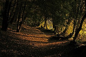
Template:FP-Pilgrims' Way
 |
Pilgrims' WayThe Pilgrims' Way is a long-distance footpath between Winchester in Hampshire, through Surrey and on to Canterbury in Kent, passing along the ridge of the North Downs. The route is popularly believed locally to be a Mediæval pilgrim route between Winchester and the shrine of Thomas Becket in Canterbury, but the reality is more modern, prosaic and eccentric. The path was in fact first invented, defined and named by an officer of the Ordnance Survey in the nineteenth century and has become established in the public imagination since then. (Read more) |