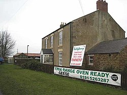
Murton, Northumberland
| Murton | |
| Northumberland | |
|---|---|
 Murton Moor Farm | |
| Location | |
| Grid reference: | NZ328708 |
| Location: | 55°1’52"N, 1°29’13"W |
| Data | |
| Post town: | Newcastle Upon Tyne |
| Postcode: | NE27 |
| Dialling code: | 0191 |
| Local Government | |
| Council: | North Tyneside |
| Parliamentary constituency: |
Tynemouth |
Murton is a small village in Northumberland, mercifully separated from the encroaching conurbation by fields beyond which are West Monkseaton, New York, Earsdon and Shiremoor.
The village contains a public house, the Robin Hood, and an equestrian centre.
Murton Farmhouse on the New York Road is a Grade II listed building, with parts dating from the 18th century.[1]
Outside links
- Murton Network Village regeneration scheme
References
- ↑ Murton Farmhouse - British Listed Buildings