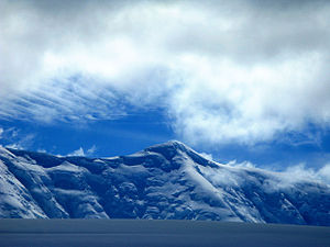
Mount Français
| Mount Français | |||
| British Antarctic Territory | |||
|---|---|---|---|
 Mount Français | |||
| Range: | Trojan Range | ||
| Anvers Island | |||
| Summit: | 9,055 feet 64°37’60"S, 63°27’0"W | ||
Mount Français is a mountain which forms the summit of Anvers Island in the Palmer Archipelago of the British Antarctic Territory. It stands southeast of the centre of the island and 6 miles north of Borgen Bay. Mount Français has an elevation of 9,055 feet and is part of the Trojan mountain range.
History
Mount Français was first seen by the members of the Belgian Antarctic Expedition, who explored the southeast coast of the island in 1898. It was later sighted by the French Antarctic Expedition team members, 1903–05, under Jean-Baptiste Charcot, who named it for the expedition ship, Français.
Mount Français was first summited on 7 December 1955 by Jim Rennie, Arthur Shewry, and Bill Hindson, members of the Falkland Islands Dependencies Survey who had spent the 1955 winter at Base E, newly constructed north of Arthur Harbour on Anvers Island.[1]
Outside links
- 'Mount Français, Antarctica' on Peakbagger
References
- Gazetteer and Map of The British Antarctic Territory: Mount Français