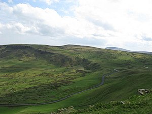
Robin Young's Hill
| Robin Young's Hill | |||
| County Antrim | |||
|---|---|---|---|
 Robin Young's Hill | |||
| Range: | Antrim Hills | ||
| Summit: | 1,260 feet D336067 54°53’25"N, 5°55’6"W | ||
Robin Young's Hill is a hill amongst the Antrim Hills, at the north end of the dramatic Sallagh Braes.
The cliffs of the east of the hill for a narrow promontory east of the summit called 'Knock Dhu'; a common name across Ireland and the Highlands, meaning 'Black Hill'. The remains of an ancient promontory fort have been found here.
The Antrim Hills Way and the Ulster Way share a track over the hill on the way between Scawt Hill to the north and Agnew's Hill to the south.