Agnew's Hill
| Agnew's Hill | |||
| County Antrim | |||
|---|---|---|---|
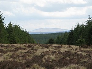
 Agnew's Hill rises behind the forest | |||
| Range: | Antrim Hills | ||
| Summit: | 1,555 feet D327018 54°50’48"N, 5°56’5"W | ||
Agnew's Hill is a mountain in the Antrim Hills of County Antrim, reaching 1,555 feet. One of the highest of the range, its rounded, peat-blanketed top stands five miles due west of Larne, above the broad dale of the Six Mile Water.
The Ulster Way long-distance walking route, running over the hills, crosses the summit of Agnew's Hill, and the Antrim Hills Way follows it this far, turning westwards at the summit towards Slemish. The summit provides wide views over the Antrim Hills.
The delightfully named Starbog Road runs over the hill.
Outside links
