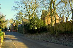
Shenton


Shenton is a hamlet in western Leicestershire, lying about two miles south-west of Market Bosworth. The hamlet is included in the civil parish of Sutton Cheney. Shenton originates as a chapelry and township of the ancient parish of Market Bosworth.[1] The settlement is almost entirely agricultural, containing several farms. Much of the land has been in the same family since William Wollaston purchased the manor in 1625. It is essentially a privately owned estate village and has seen comparatively little modern development.[2] It has been designated a conservation area.[3]

The settlement lies either side of the Sence Brook, which is crossed by a picturesque Victorian bridge. The area is fairly flat, and subject to flooding.
The hall has a fine gatehouse dated 1629, and a large, listed dovecote of 1719 within the hall grounds, close to the stable block.[4] The main building was enlarged in the C19th.[5] The hall itself was sold by the Wollaston family following government requisition during the Second World War, but most of the estate land in the settlement and the surrounding farmland, was not sold. The church of St John the Evangelist is part of the 'Benefice of Sheepy' sheepybenefice.org </ref> It was rebuilt by the Wollaston family in about 1860.[6] There is a C17th memorial to William Wollaston which was moved into the church. Admiral Sir Alexander Dundas Young Arbuthnott is buried in the churchyard.
Shenton is close to the site of the Battle of Bosworth, which took place south-west of Market Bosworth. It is one of the four settlements named by the early C17th historian and local man, William Burton (of Lindley), to define the area of the battlefield.[7] Some of the estate was subject to intensive archaeological surveying in recent years as part of the project to locate the battlefield. The first, highly significant, find of round shot was made just west of Mill Lane, which leads from Shenton to Fenn Lanes Roman road.[8]
The Ashby Canal passes to the east of the village and the road to Sutton Cheney and Market Bosworth passes beneath it through a narrow aqueduct tunnel.
Shenton station lies some way from the village on the Sutton Cheney side, east of the canal. It is the southern terminus of the preserved Battlefield Line Railway, which runs to Shenton from Shackerstone. This is a section of what was originally the Ashby to Nuneaton railway line, opened in 1873.[9] The station is located at the foot of Ambion Hill and is actually the reconstructed Humberstone Road Station from Leicester. The original Shenton station was demolished in the 1940s, except for a small lamp room that now serves as the Station Pottery.
References
- ↑ William White, History, Gazetteer and Directory of Leicestershire, (Sheffield, 1846) p.576
- ↑ http://www.hinckley-bosworth.gov.uk/downloads/file/1283/appraisal_and_map
- ↑ Bosworth Battlefield: The Way Forward, (Alison Farmer Associates, Cambridge 2013) p.37
- ↑ https://historicengland.org.uk/listing/the-list/list-entry/1074248
- ↑ http://www.heritagegateway.org.uk/Gateway/Results_Single.aspx?uid=1178135&resourceID=5
- ↑ Nikolaus Pevsner, Leicestershire and Rutland (Buildings of England), (Penguin Books, 1985)
- ↑ Peter Foss, The Field of Redemore: The Battle of Bosworth, 1485 (Kairos Press, 1998)
- ↑ Glenn Foard & Anne Curry, Bosworth 1485, A Battlefield Rediscovered, (Oxford, Oxbow Books, 2013), p.109
- ↑ http://www.battlefield-line-railway.co.uk/
Outside links
- Location map: 52°35’54"N, 1°25’56"W