Farlow
| Farlow | |
| Shropshire, Herefordshire | |
|---|---|
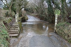
 Ford through the Farlow Brook, between Farlow and Oreton | |
| Location | |
| Grid reference: | SO640806 |
| Location: | 52°25’19"N, 2°31’44"W |
| Data | |
| Population: | 445 (2011) |
| Post town: | Kidderminster |
| Postcode: | DY14 |
| Dialling code: | 01746 |
| Local Government | |
| Council: | Shropshire |
| Parliamentary constituency: |
Ludlow |
Farlow is a small village and civil parish in Shropshire. The population at the 2011 census was 445.[1]
The chapelry of Farlow in the ancient parish of Stottesden forms a detached part of Herefordshire, part of the hundred of Wolphy. Although the most northerly part of the main body of the county is at Leintwardine, Farlow is further north, and therefore forms the most northerly part of the county when detached parts are taken into account.
Nearby is the small town of Cleobury Mortimer. The village of Oreton lies in the civil parish.
References
| ("Wikimedia Commons" has material about Farlow) |

This Shropshire article is a stub: help to improve Wikishire by building it up.
