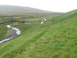
Crook Burn

The Crook Burn is a tributary of the Daer Water in Lanarkshire. It is the southernmost tributary of the River Clyde watershed and thus the southernmost point of the county. It now flows into the Daer reservoir just to the south-east of its natural confluence.
Its source is situated near Queensberry Hill in an area called Fortypenny Moss.
Outside links
- Location map: 55°17’39"N, 3°35’33"W
This River article is a stub: help to improve Wikishire by building it up.