Calcott, Shropshire
| Calcott | |
| Shropshire | |
|---|---|
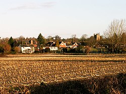
 Farmland at Calcott | |
| Location | |
| Grid reference: | SJ449139 |
| Location: | 52°43’12"N, 2°48’54"W |
| Data | |
| Post town: | Shrewsbury |
| Postcode: | SY3 |
| Dialling code: | 01743 |
| Local Government | |
| Council: | Shropshire |
| Parliamentary constituency: |
Shrewsbury and Atcham |
Calcott is a hamlet in the midst of Shropshire. It is to be found strung along a lane to the north-west of the county town, Shrewsbury, separated from the swollen townscape of its suburbs by less than half a mile of green fields.
Immediately to the north is Bicton (within whose parish it falls) and to the south is Bicton Heath, a new suburb at the edge of Shrewsbury. The A5 road narrowly misses the hamlet.
Outside links
| ("Wikimedia Commons" has material about Calcott, Shropshire) |
