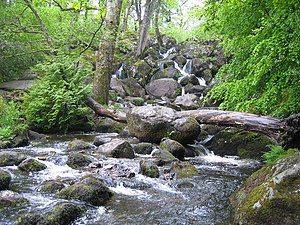
Becky Falls
| Becky Falls | |
| Devon | |
|---|---|
 Becky Falls | |
| River: | Becka Brook |
| SX76188008 | |
| Co-ordinates: | 50°36’25"N, 3°45’25"W |
Becky Falls, originally known as Becka Falls, is a waterfall on Dartmoor, Devon, which is now the centre of a tourist attraction occupying the gorge in which the falls are found. There are two sets of falls, where the Becka Brook tumbles down through a small gorge on its way to the River Bovey (which meeting is about a mile and a half downstream). In the gorge, the waterfall tumbles about 65 feet down a boulder-strewn bed.
In addition to the waterfall as the centrepiece, the visitor site includes a woodland park with features such as a children's zoo, woodland trail, and crafts.[1][2]
Waterfall
The waterfall is on the Becka Brook, one of the main tributaries of the River Bovey. The brook rises just south of Hound Tor, and continues through Becky Falls before reaching the Bovey just below Trendlebere Down.[3]
As the brook passes through, there are two sets of waterfalls created, with a drop of around 65 feet.[4]
The falls were originally known as Becka Falls, including on Ordnance Survey maps up until the 1940s, but the name was changed to increase its appeal as a tourist attraction.[5]
Outside links
References
- ↑ "Family Activities". Becky Falls. http://www.beckyfalls.com/.
- ↑ "Becky Falls". Visit Dartmoor. http://www.visitdartmoor.co.uk/things-to-do/becky-falls-p1374923.
- ↑ Bovey Valley – Teign Catchment
- ↑ "The Waterfalls of Dartmoor". Legendary Dartmoor. http://www.legendarydartmoor.co.uk/water_falls.htm.
- ↑ "Becky Falls". Photographer's resource. http://www.photographers-resource.co.uk/locations/Nature/Waterfalls/LG/Becky_falls.htm.