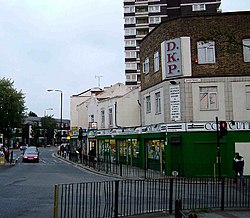
Plaistow
| Plaistow | |
| Essex | |
|---|---|
 Plaistow High Street | |
| Location | |
| Grid reference: | TQ405825 |
| Location: | 51°31’27"N, -0°1’28"E |
| Data | |
| Post town: | London |
| Postcode: | E13 |
| Dialling code: | 020 |
| Local Government | |
| Council: | Newham |
| Parliamentary constituency: |
West Ham |
Plaistow is a town in soth-western Essex within the London conurbation. It is contiguous with Forest Gate to the north, West Ham to the west, Canning Town to the south, and East Ham to the east.

This Essex article is a stub: help to improve Wikishire by building it up.