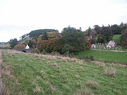
Newlands, Peeblesshire
| Newlands | |
| Peeblesshire | |
|---|---|
 Newlands | |
| Location | |
| Grid reference: | NT160465 |
| Location: | 55°42’20"N, 3°20’17"W |
| Data | |
| Post town: | West Linton |
| Postcode: | EH46 |
| Dialling code: | 01968 |
| Local Government | |
| Council: | Scottish Borders |
Newlands is a hamlet and parish in Peeblesshire. The hamlet lies by a bridge carrying the B7059 road over the Lyne Water, beneath the slopes of White Knowe. The wider parish is bounded by West Linton to the west; by Kirkurd, Stobo and Lyne to the south; by Eddleston to the east; and by Penicuik in Midlothian to the north. It had a population of 653 in 2011.
Little remains of the village today. It has the remains of the Newlands Kirk, and a manse.
The Flemington Path is a signed public footpath between Newlands and Peebles.
Outside links
| ("Wikimedia Commons" has material about Newlands, Peeblesshire) |
