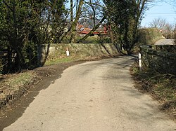
Pentreheyling
| Pentreheyling | |
| Shropshire | |
|---|---|
 Bridge over the River Caebrita into Pentreheyling | |
| Location | |
| Grid reference: | SO242929 |
| Location: | 52°31’44"N, 3°7’1"W |
| Data | |
| Post town: | Montgomery |
| Postcode: | SY15 |
| Dialling code: | 01588 |
| Local Government | |
| Council: | Shropshire |
| Parliamentary constituency: |
Ludlow |
Pentreheyling is a hamlet in Shropshire, adjacent to the border with Montgomeryshire. It lies just west of Brompton on the A489 road between Churchstoke and Newtown.
Pentreheyling falls within the township of Brompton in the ancient parish of Churchstoke and the civil parish of Chirbury with Brompton.
The remains of a Roman fort have been discovered in the hamlet.[1][2]
References
| ("Wikimedia Commons" has material about Pentreheyling) |

This Shropshire article is a stub: help to improve Wikishire by building it up.
