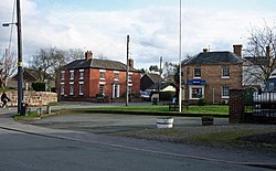
Kinnerley
| Kinnerley Welsh: Chen-ar-dinlle | |
| Shropshire | |
|---|---|
 Kinnerley village centre | |
| Location | |
| Grid reference: | SJ337209 |
| Location: | 52°46’52"N, 2°58’55"W |
| Data | |
| Population: | 1,108 (2011[1]) |
| Post town: | Oswestry |
| Postcode: | SY10 |
| Dialling code: | 01691 |
| Local Government | |
| Council: | Shropshire |
| Parliamentary constituency: |
North Shropshire |
Kinnerley is a small village and parish in Shropshire, adjacent to the border with Montgomeryshire.
The village was a stop on the now defunct Shropshire and Montgomeryshire Railway, that ran from 1866 to 1960. The village today has a primary school, a church, a cemetery, and a shop. Its pub (the Cross Keys) closed in 2014 following a fire.[2] On the 1st October 2015 the pub was purchased as a community asset to be refurbished and re-opened in the future. It is a small village separating neighbouring villages Dovaston and Pentre and the nearest town is Oswestry. To the north is the village of Knockin.
It is home to the acting society known as "The Kinnerley Players" and also has its own football team.
History

A mile to the south is the motte-and-bailey castle known as Belan Bank.
John Bridgeman, Bishop of Chester, who died in 1652, is buried in the church.[3]
Wartime role
In the Second World War the area around the village became a top-secret bomb storage depot. Kinnerley was chosen because of its central location within the UK and because it had a railway link. The line was operated by the military (until it was closed in 1960).
The huge site, which had extensive sidings and covered buildings, was created by the Royal Engineers:
More than 200 huge storage sheds, camouflaged and decked out with turfed roofs, were built around the village of Kinnerley. Each was served by a railway siding which entered each building, allowing the highly dangerous cargo to be unloaded inside. BBC
The area was heavily guarded and was not declassified till the mid 1950s.
References
| ("Wikimedia Commons" has material about Kinnerley) |
- ↑ "Civil Parish population 2011". http://www.neighbourhood.statistics.gov.uk/dissemination/LeadKeyFigures.do?a=7&b=11125263&c=Kinnerley&d=16&e=62&g=6460598&i=1001x1003x1032x1004&m=0&r=1&s=1448107649672&enc=1. Retrieved 21 November 2015.
- ↑ "Call for villagers to attend meeting over future of pub". Shropshire Star: p. 5. 17 January 2015.
- ↑ Dictionary of National Biography, : Bridgeman, John

This Shropshire article is a stub: help to improve Wikishire by building it up.
