Porthgwarra
| Porthgwarra | |
| Cornwall | |
|---|---|
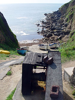
 Slipway and winch at Porthgwarra | |
| Location | |
| Grid reference: | SW371217 |
| Location: | 50°2’15"N, 5°40’19"W |
| Data | |
| Post town: | Penzance |
| Postcode: | TR19 |
| Dialling code: | 01736 |
| Local Government | |
| Council: | Cornwall |
| Parliamentary constituency: |
St Ives |
Porthgwarra is a small coastal village in the civil parish of St Levan, Cornwall, between Land's End and Porthcurno. Access to the cove is by way of a minor road off the B3283 at Polgigga and leads to the car park in the village.
Public conveniences include a pay telephone, a small shop and café. The South West Coast Path passes through Porthgwarra, and on the path it is about 90 minutes' walk from Land's End and 45 minutes from Porthcurno.
The village's name is from the Cornish Porth Gorwedhow, meaning 'very wooded cove'.
The cove


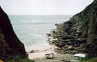
The cove and slipway are privately owned, but the public are permitted to quietly and respectfully enjoy them. Swimming in the cove is safe, provided swimmers do not go beyond the headland where there are dangerous, strong sea currents.
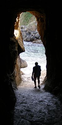
At the foot of the cove's slipway is a tunnel dug by tin miners from St Just to give farmers horse-and-cart access to the beach to collect seaweed to use as a fertiliser. A second tunnel, leading seawards, is the fishermen's access to the tidal 'hulleys' built in the rocks to store shellfish. The 'hulleys', which ceased being used about 20 years ago, had wooden floors and topcovers with trapdoors and were used to store shellfish prior to taking the catch to market once or twice a week.[1] The rope laid down the beach is used to steady boats while landing.
Outside links
| ("Wikimedia Commons" has material about Porthgwarra) |
References
- ↑ Tange, Michael (1973). "Hulls in Cornwall: a survey and discussion". Cornish Archaeology 12: 31–52.
