Lank
| Lank | |
| Cornwall | |
|---|---|
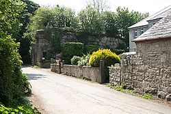
 By Lower Lank Cottage, Lank | |
| Location | |
| Grid reference: | SX091752 |
| Location: | 50°32’52"N, 4°41’52"W |
| Data | |
| Postcode: | PL30 |
| Local Government | |
| Council: | Cornwall |
Lank is a little village settlement in Cornwall, which may be found about a mile south of St Breward, in whose parish it falls, and six miles east-northeast of Wadebridge.
The settlement consists of two hamlets, Higher Lank (to the north) and Lower Lank (to the south), situated on high ground between the valleys of the River Camel and De Lank River, from the latter of which the hamlets take their name.
About the village
The De Lank Quarry is half-a-mile east of Lower Lank, where granite is quarried. The quarry is still operational and is currently owned by Ennstone, a multinational asphalt and aggregates business.
Wenfordbridge is half-a-mile to the west and was the terminus of a branch of the Bodmin and Wadebridge railway. A siding from Wenfordbridge ran between Higher Lank and Lower Lank and served the quarry via a rope-worked incline. The siding shut in 1940 but rail services to Wenfordbridge continued until 1985.[1]
The trackbed of the line south of Wenfordbridge is now part of the Camel Trail long distance path and cycleway.[2]
References
- ↑ Vic Mitchell and Keith Smith; Branch Lines Around Bodmin; Middleton Press; 1996); ISBN 978-1-873793-83-1
- ↑ The Camel Trail - Cornwall Council