Godolphin Hill
| Godolphon Hill | |
| Cornwall | |
|---|---|
 Godolphin Hill | |
| Summit: | 531 feet SW592312 50°7’58"N, 5°22’14"W |
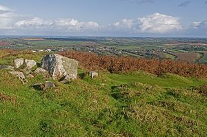
Godolphin Hill is a modest hill in western Cornwall, overlooking Mounts Bay on the south coast of the county. It is within the Godolphin Estate, once the lordly estate of the Godolphin family which dominated this part of the county, but owned today by the National Trust. The house is under the north-west slope of the hill and the village of Godolphin Cross is to the east.
The younger reaches of the River Hayle, which eventually reaches the sea on the north coast, flow around the hill's southern slopes.
Godolphin Hill is the more northerly of two granite hills hre overlooking the bay, the other, to the south-south-west, being the somewhat larger Tregonning Hill. The hills are approximately four miles west of the town of Helston.
On the slopes of the hill are the remains of a Bronze Age hut circle. It has proven a very rich archaeological site and recent years', digs and geophysical surveys have uncovered more about the lost settlement on Godolphon Hill to which these ancient stones bear witness.[1]
References
