East Mey
| East Mey | |
| Caithness | |
|---|---|
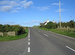
 The A836 at East Mey | |
| Location | |
| Grid reference: | ND310739 |
| Location: | 58°38’52"N, 3°11’25"W |
| Data | |
| Post town: | Mey |
| Postcode: | KW14 |
| Local Government | |
| Council: | Highland |
| Parliamentary constituency: |
Caithness, Sutherland and Easter Ross |
East Mey is a scattered crofting village on the north coats of Caithness.

This Caithness article is a stub: help to improve Wikishire by building it up.