South Normanton
| South Normanton | |
| Derbyshire | |
|---|---|
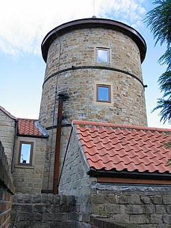
 A windmill conversion off Fordbridge Lane | |
| Location | |
| Grid reference: | SK467592 |
| Location: | 53°6’25"N, 1°20’35"W |
| Data | |
| Population: | 8,035 |
| Post town: | Alfreton |
| Postcode: | DE55 |
| Dialling code: | 01773 |
| Local Government | |
| Council: | Bolsover |
| Parliamentary constituency: |
Bolsover |
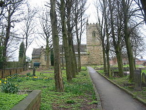
South Normanton is a village and civil parish in eastern Derbyshire, close to the border with Nottinghamshire. An ex-mining village, it is located two miles east of Alfreton and is approximately 510 feet above sea level at one of its highest points, near St Michael and All Angels Parish Church near the middle of town. The historic industries of the village were agriculture, stocking, spinning and mining.
Normanton means ‘the farm of the north men’ or 'Northwegans'. It was a purely agricultural settlement but added tanning as a secondary industry during mediæval times, using the bark of the oak and birch, both plentiful in the area. In the 18th and 19th centuries, the main industries were framework knitting and mining. The knitters, or shiners as they were known from the state of their trouser seats after a 14-hour day sitting at their machines, tended to live in certain areas, around the Dog Pool, along Water Lane and particularly up the narrow alleys around the Old Market place. South Normanton Colliery closed in 1952, B Winning in 1964 and A Winning in 1969.
Carnfield Hall was for several centuries the seat of the Revel family. The hall contains a varied collection of antique furniture, porcelain and glass, family portraits and much more. It is now a family home shown to the public by the present owners.
History
Before 1888 South Normanton was a small hamlet concerned with farming activities. There were very few buildings in the area and only a small track road leading to the settlement.

Around 1888 the only houses that were there were a few cottages around the church of St Michael, on the hilltop in South Normanton Centre and the Windmill. The church was also there of course. All the settlement and buildings at this point were clustered around the main road along the roadsides of what is now Church Street and Market Street (a linear settlement). There were farming fields around the arched shaped village.
Around 1921 the village began its main industry of mining. Many people moved in from the surrounding countryside to work in the mines. The wages they earned were better than the crops that they grew in the fields as security so they came to the village in their hundreds. Many terraced houses were built to accommodate them.
Sport
The village has some sporting facilities. The village is home to South Normanton Athletic F.C. It also has a cricket team South Normanton Cricket Club which was formed in 1990. There is also the South Normanton School of Boxing which caters for all ages from 10 up.
Famous Residents
- Jedediah Strutt (1726-1797) was born here.
- Prof Thomas Malcolm Charlton (1923-1997) was born here.
- Footballer Lee Holmes grew up in South Normanton.[1]
References
- ↑ Moxley, Neil (1 November 2007). "The history boys: Bostock's bow brings it all back to Holmes". Mail Online (Associated Newspapers). http://www.dailymail.co.uk/sport/football/article-490960/The-history-boys-Bostocks-bow-brings-Holmes.html. Retrieved 12 February 2016.
Outside links
| ("Wikimedia Commons" has material about Normanton South Normanton) |
