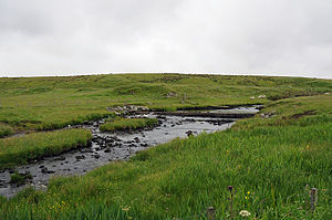
Scouthal Burn

Scouthal Burn has its source in the Flow Country of Caithness, at an elevation of only 160 feet above sea level, at the meeting of the Burn of Achorole and Alt Feithe Buidhe about two miles south of Watten.
Scouthal Burn meanders generally north/north-westward, across a distance of about a mile with the Moss of Badarclay to its east, to join Strath Burn and so form the source of the Wick River about half a mile south of Watten.
Outside links
- Location map: 58.45889 -3.305