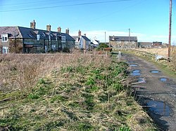
Low Hauxley
| Hauxley | |
| Northumberland | |
|---|---|
 Low Hauxley | |
| Location | |
| Grid reference: | NU267041 |
| Location: | 55°19’6"N, 1°33’4"W |
| Data | |
| Population: | 279 (2011)) |
| Post town: | Morpeth |
| Postcode: | NE65 |
| Dialling code: | 01665 |
| Local Government | |
| Council: | Northumberland |
| Parliamentary constituency: |
Berwick-upon-Tweed |
Low Hauxley is a small village in Northumberland, just a mile from Amble, south along the lane along the seafront. It is combined with High Hauxley, a little inland, to give a civil parish of Hauxley.
Near the village is an important archaeological site, with an early Bronze Age cemetery as well as Mesolithic and Iron Age remains, but with much erosion. A major rescue dig was mounted for 13 weeks, between June and September 2013. Results were broadcast on Channel 4's Time Team special on 2 March 2014.[1]
References

This Northumberland article is a stub: help to improve Wikishire by building it up.